Miyakojima Guide: Airports, Bridges and Beach Planning
Contents
Miyakojima planning starts with three checks: which airport is on your ticket, how you will get between the places you want to visit, and whether the sea is suitable for your plans on the day. Miyako Airport and Shimojishima Airport are separate facilities with different bus information, so do not arrange a transfer until you have confirmed your arrival and departure airports. Likewise, a beach that looks calm or appears in a travel video is not automatically safe for swimming.
This guide brings together the available information on the two airports, the bridges and districts, Sunayama Beach, and the tourism association’s safety advice. Some details—such as the facilities listed on an older beach page—are not confirmed as current. Treat operator notices and local conditions on your actual travel date as more important than a general route description or an old listing.
Miyakojima guide: the two airports
Miyako Airport is in the central part of Miyakojima, while Shimojishima Airport is at Sawada 1727, Irabu, Miyakojima City. They are different arrival points and have different published public-transport options. First check the airport name on your flight booking, then check the relevant airport or bus operator’s information for your travel date rather than assuming that a bus will connect with a particular flight.
The airport information below was checked on 4 November 2026. Timetables, fares, reservations, temporary suspensions and the suitability of a service for a specific flight have not been confirmed here, so use the linked operator pages to check current details before travelling. Allow time to identify the right bus stop and payment procedure, especially if you are arriving with luggage or arranging a return journey.
| Arrival point | Published onward option | What the airport information says | What to confirm |
|---|---|---|---|
| Miyako Airport | Regular route buses | The airport FAQ describes regular route buses, not a dedicated airport shuttle. | The route, timetable, fare and service on your travel date. |
| Shimojishima Airport | Chuo Kotsu Airport Liner | The airport bus page describes service toward Hirara Port and Miyako Airport, with tickets purchased at a counter near the international arrivals exit. | Current timetable, fare, counter arrangements and whether the service fits your flight. |
| Shimojishima Airport | Miyako Kyoei resort bus | The page describes service via Miyako Airport toward the Miyakojima Tokyu Hotel area; passengers go to the bus stop and pay when alighting. | Current service, fare, stop location and travel time for your journey. |
Miyako Airport: location, bus access and parking
Miyako Airport is described as being in the central area of Miyakojima. Its FAQ gives an approximate journey of 15–25 minutes between the airport and the city centre, and identifies regular route buses rather than a dedicated airport shuttle. The estimate is a general guide, not a guarantee of the time needed on a particular day or for a particular connection. Check the Miyako Airport FAQ for the airport’s own current information.
The terminal is listed as available from 07:00 to 21:00, and an ATM is listed in the arrivals lobby. If you expect to need cash, note the ATM location, but do not assume that it will resolve every payment need for your onward journey; check the selected bus operator’s payment information separately. If weather disrupts your flight, the airport advises passengers to ask their airline about cancellations or changes.
The FAQ also lists parking at 100 yen per hour for up to nine hours, and 1,000 yen for more than nine hours up to 24 hours. These are the stated parking rates in the information checked on 4 November 2026; confirm the current terms with the airport before relying on them. If someone is collecting you, agree on the airport and terminal in advance so that a change of plan does not send them to the wrong facility.
Shimojishima Airport: two listed bus options
Shimojishima Airport is at Sawada 1727, Irabu, Miyakojima City. Its bus access page lists two different services: the Chuo Kotsu Airport Liner, which goes toward Hirara Port and Miyako Airport, and a Miyako Kyoei resort bus that runs via Miyako Airport toward the Miyakojima Tokyu Hotel area. The listed destinations are useful for comparing the options, but they do not establish that either bus will meet your flight.
The airport page describes different procedures for the two operators. For the Airport Liner, it says to buy a ticket at the counter near the international arrivals exit; for the Miyako Kyoei service, it says to go directly to the bus stop and pay when getting off. Check the current instructions before boarding, since the information here does not confirm present fares, departure times, reservation requirements or temporary suspensions.
Road conditions and connections affect journey times, so treat any stated duration as an estimate rather than a fixed transfer promise. Check the outward and return journeys independently, including the correct boarding point and the time available before a flight. If your accommodation or another service offers a transfer, confirm the pickup airport with that provider rather than assuming it covers both airports.
Miyakojima guide: bridges and areas
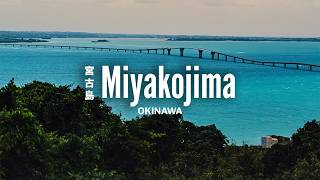
The tourism association describes Hirara as the central urban area and identifies places of interest across several districts and connected islands. Ikema Bridge connects Ikema Island with Miyako Island and is listed as 1,425 metres long; Irabu Bridge is listed as 3,540 metres long. Kurima Island is connected by Kurima Bridge, and the association lists the Ryugujo observatory there.
These names help you group places when planning, but bridge length does not tell you how long a visit or drive will take. Nor does a scenic view confirm that a bridge is open without restriction or that a nearby beach is suitable for swimming. Use the Miyakojima tourism association’s regional guide to identify the areas, then check current conditions for the specific road, viewpoint or beach before setting out.
| Area or island | Place identified by the tourism association | Practical planning check |
|---|---|---|
| Hirara | Central urban area | Check how your accommodation and onward transport fit your plans. |
| Irabu | Toguchi no Hama | Check current access and beach conditions before visiting. |
| Shimoji | Yonaha Maehama | Check present facilities and swimming conditions. |
| Kurima Island | Ryugujo observatory | Check weather and any current bridge or access restrictions. |
| Gusukube | Higashi-Hennazaki | Check transport and weather for the day. |
| Ikema Island | Connected to Miyako Island by Ikema Bridge | Check road conditions and any restrictions before travelling. |
Grouping places without assuming a fixed route
The tourism association presents Hirara as the central urban area and identifies attractions in Irabu, Shimoji, Kurima Island and Gusukebe. Use that information to group places you want to see before deciding how to travel between them. The source does not provide a guaranteed journey time for these connections, so avoid building a tight schedule around the bridge lengths or a photograph’s apparent distance.
Miyakojima is described by the association as having a relatively flat landform formed by uplifted coral reef. That description explains the broad character of the island, but it is not a guide to walking conditions, wind exposure or the surface at a particular stop. For any day that involves several outdoor places, consider which locations matter most and check conditions before committing to the whole plan.
The bridges are useful links between the main island and neighbouring islands, but they are still roads subject to current conditions. Before leaving, check for traffic, weather or access notices where available, and do not stop on a roadway to take photographs. A bridge’s length and scenery are not evidence that it is safe to swim nearby or that a beach on the other side is open.
Miyakojima guide: Sunayama Beach
Sunayama Beach is reached by crossing a small sand hill, according to the tourism association’s beach page. The page, updated in December 2018, lists parking, toilets and showers and gives about 20 minutes by car from Miyako Airport. Those are details from that dated listing, not confirmation that the facilities are operating now or that access is unchanged.
Before setting out, check current access information and whether the facilities you need are available. The old listing does not establish present opening arrangements, swimming permission, supervision or restrictions. The Sunayama Beach page is useful for the described approach and the warnings it records, but should not be treated as a live beach-status report.
The same page warns that westerly winds can create waves and that the water can become suddenly deep offshore. Those cautions are reasons to assess actual conditions and local guidance, not a complete report on the sea on your visit date. A beach can be attractive for a walk or a view even when entering the water is not appropriate.
What the older Sunayama listing does—and does not—confirm
The page records a car journey of about 20 minutes from Miyako Airport and lists a parking area, toilets and showers. Because the page was updated in December 2018, these details should be treated as information published at that time, not a promise that every facility is available today. Check current local information before relying on parking, toilets or showers, especially if those facilities are important to your plans.
The page also records two specific sea cautions: waves may rise with westerly winds, and the water becomes deep suddenly in some offshore areas. Neither caution tells you the exact conditions on a particular day, and a favourable-looking photograph cannot replace a current assessment. If you are unsure about the water, do not enter it; follow any posted restrictions and local advice.
Crossing a sand hill is part of the approach described by the page, so consider that detail when planning for anyone who may find walking over sand difficult. The available facts do not confirm the current path condition, accessibility arrangements or any temporary access controls. Check locally rather than assuming that the older description covers every visitor’s needs.
Miyakojima guide: beach and weather precautions
The tourism association advises against swimming in strong winds or high waves, in prohibited areas, or after drinking alcohol. It also advises against swimming when tired or short of sleep, says children should not swim alone, and does not recommend swimming at beaches with few people around. Some locations can be difficult for emergency vehicles to reach, so the absence of other people is a practical safety concern as well as a reason not to rely on help arriving quickly.
The association also warns that sea conditions may still be affected after a typhoon even when the weather has become sunny. Check conditions and current local notices on the day, and do not treat clear skies as proof that the water is safe. Read the tourism association’s visitor precautions before your trip and follow local signs or instructions at the beach.
The same guidance asks visitors to take rubbish away and avoid making cars or shops dirty with sand or wet swimwear. Bring a plan for handling used swimwear and sandy items before getting into a vehicle or entering a business. Individual beaches can differ in supervision, facilities, access and restrictions, so check the arrangements for the beach you actually intend to visit rather than relying on a general island description.
Make the beach decision on the day
Separate the decision to visit a beach from the decision to swim. You may be able to plan a visit for a view or a walk while deciding not to enter the water, depending on access and local conditions. The official safety guidance is clear that strong winds, high waves and prohibited areas are reasons not to swim, and no general guide can replace the day’s conditions.
Do not swim alone, and do not let children swim alone. Avoid entering the water after alcohol, when tired or when short of sleep, and take particular care at places where few people are present. The association notes that emergency vehicles may have difficulty reaching some locations, which makes prevention and following local restrictions especially important.
After a typhoon, sunny weather does not necessarily mean that the sea has returned to safe conditions. Check current wind and sea information and local notices before deciding to swim, and be willing to change plans. Take rubbish away and keep sand and wet swimwear from soiling cars or shops, as requested in the association’s visitor guidance.
Miyakojima guide: questions before travelling
Airport, bridge and beach decisions are connected, but the facts do not support treating them as one fixed itinerary. Confirm your airport first, choose the relevant bus information next, and check the destination’s current access and sea conditions before leaving. The answers below clarify what the available official information says and what still needs checking.
Are Miyako Airport and Shimojishima Airport the same place?
No. They are separate facilities, and the published transport information is different for each one. Miyako Airport describes regular route buses, while Shimojishima Airport lists the Airport Liner and a Miyako Kyoei resort bus; confirm the airport name on your ticket before arranging a transfer.
How do I get from Shimojishima Airport by bus?
The airport page lists the Chuo Kotsu Airport Liner toward Hirara Port and Miyako Airport, and a Miyako Kyoei resort bus that travels via Miyako Airport toward the Miyakojima Tokyu Hotel area. The page says to purchase an Airport Liner ticket at the counter near international arrivals, while the resort-bus instructions say to go to the bus stop and pay when alighting. Check current fares, times, stop details and service notices on the official bus access page, including whether the service works for your flight.
Does Miyako Airport have a dedicated airport shuttle?
The Miyako Airport FAQ describes regular route buses rather than a dedicated airport shuttle. It gives an approximate 15–25 minutes between the airport and the city centre, but that estimate is not a guaranteed travel time for a specific connection. Check the airport FAQ and the chosen bus operator’s current information before relying on a route.
What is listed at Miyako Airport for passengers and parking?
The airport FAQ lists terminal use from 07:00 to 21:00 and an ATM in the arrivals lobby. It lists parking at 100 yen per hour for up to nine hours, and 1,000 yen for more than nine hours up to 24 hours. These are the listed details checked on 4 November 2026, so confirm current terms directly with the airport before your visit.
Which bridges connect the islands?
The tourism association says Ikema Bridge connects Ikema Island with Miyako Island and lists its length as 1,425 metres. It lists Irabu Bridge as 3,540 metres long, and describes Kurima Bridge as connecting Kurima Island with Miyako Island. These lengths identify the structures, not the time needed to travel across them or a guarantee that there will be no weather or traffic restrictions.
Is Sunayama Beach’s parking and shower available now?
The tourism association’s Sunayama page was updated in December 2018 and listed parking, toilets and showers. That listing does not confirm whether those facilities are operating now, and it does not establish present access or swimming arrangements. Check the Sunayama information page and current local information before relying on the facilities.
Is it safe to swim at Sunayama Beach?
The older beach page warns that westerly winds can create waves and that the water can become suddenly deep offshore. Those warnings do not establish the conditions on your visit date, so check current conditions and any local restrictions before deciding whether to enter the water. The tourism association advises against swimming in strong winds, high waves or prohibited areas, and its visitor precautions should be read alongside local guidance.
Can children swim alone, or can I swim after a drink?
The tourism association says children should not swim alone and advises against swimming after drinking alcohol. It also advises against swimming when tired or short of sleep, and does not recommend swimming at sparsely populated beaches. Follow posted restrictions and local advice, and do not enter the water if conditions are unsuitable.
Is a sunny day after a typhoon enough to make swimming safe?
No. The tourism association warns that the sea can remain affected after a typhoon even when the weather turns sunny. Check current sea conditions and local notices rather than judging safety from the sky alone, and do not swim if wind, waves or restrictions make it inappropriate.
What should I do if bad weather changes my flight?
Miyako Airport’s FAQ advises passengers to contact their airline about cancellations or changes during bad weather. Check directly with the airline responsible for your flight rather than assuming that an airport bus or other service will adjust to a change. Recheck your transport plan as well, since the available information here does not confirm how a disruption will affect a particular bus service.
Should I bring rubbish back from the beach?
Yes. The tourism association’s visitor guidance asks people to take rubbish away. It also asks visitors to avoid soiling vehicles and shops with sand or wet swimwear, so plan how to contain those items before travelling on from the beach.
For broader transport context, see the JGO! guides to getting to Okinawa, Naha Airport to Naha and Japanese public transport. These general guides do not replace the airport-specific information and bus timetables for Miyakojima. For a map search, use Google Maps for Okinawa, Japan, then check the precise destination and current access details separately.
Travel videos can help you recognise places, but a creator’s earlier visit does not confirm today’s sea conditions, access or service availability. The following creators have published Miyakojima or island-trip material: